


Magic Earth Navigation & Maps
1.6954.00 Reviews
App Specs
- Version
- 7.1.26.8.0D340BB6.5A28C3D61
- Updated On
- License
- Free
- Downloads
- 1,000,000+
- Developer
- Magic Lane International BV
- Categories
- Maps & Navigation
- Platform
- Android, iOS
Screenshots
 Analysis by AppCompare
I judge a navigation app not just by whether it can draw a route, but by how comfortably I can read and follow it when my attention is split between the screen, the road, and everything happening around me. Magic Earth Navigation & Maps is a maps and navigation app from Magic Lane International BV. It is free to start, rated for everyone, and has reached over a million installs. Its average rating is 1.6 from around 42,000 ratings, a low score worth taking seriously rather than brushing aside. I would treat it as an option to test on familiar routes before relying on it for an important trip.
Reading the map and following a route
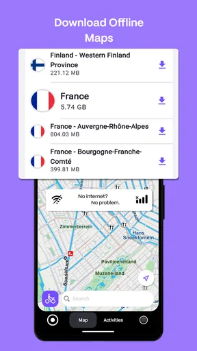
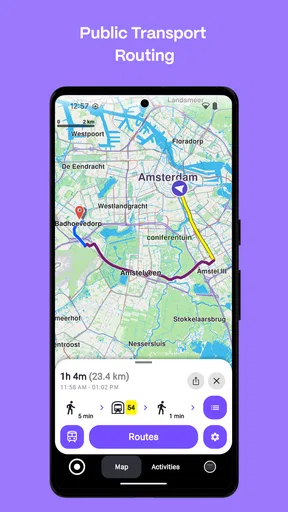
The app’s appeal is easy to understand: it brings navigation together with maps that can be downloaded for offline use, plus traffic information contributed by users. The offline option is useful when mobile coverage is uncertain, but it also changes how I would prepare. I would download the relevant area while connected, check that the map is available on the device, and avoid assuming that an offline map means every live detail will remain current without a connection.
The published version is 7.1.26.8.0D340BB6.5A28C3D61, and the minimum operating-system requirement is 9. Those details are practical checks before installing, especially if you plan to use an older phone or tablet. The app also offers in-app purchases at $19.99 per item, so I would look carefully at what a purchase covers before paying; the basic app is free, but that does not make every optional item free.
Readable guidance is only part of accessibility
A map can look clean and still be hard to use at the exact moment a turn appears. In my experience, the most useful test is not leisurely browsing at home but following a route in a safe, familiar setting and noticing whether labels, route lines, and prompts are easy for you to pick out quickly. I would set a destination before setting off, rather than trying to type or inspect the map while moving.
Voice guidance can reduce the need to keep glancing down, which is helpful for drivers and for anyone who finds small on-screen details tiring. It is not a complete substitute for visual cues: a spoken instruction can arrive at a busy junction when you are already processing traffic, signs, and lane choices. I would keep the phone mounted where it can be seen without obstructing the view, and use the app alongside road signs rather than treating either one as infallible.
Motor and sensory considerations
Touchscreen navigation can be demanding for people with limited dexterity, tremor, or difficulty making precise taps. A practical workaround is to enter the destination and review the route before leaving, then minimize interaction during the trip. If you are walking or cycling, stopping in a safe place before changing a setting is a better habit than trying to operate the phone while moving.
Sound is not equally useful in every setting. Someone who is hard of hearing may prefer to rely more on the map and route cues, while a person sensitive to spoken prompts may want to test the audio in a quiet place first. I would not assume that one presentation style works for everyone; the best choice depends on your hearing, vision, attention, and surroundings. For a passenger helping with navigation, the app may be easier to manage than for a driver who must keep their eyes and hands available.
Worth Reading Before You Choose

EA SPORTS FC Mobile 26 Is a Bigger Football Game, but It Takes Time

Flipboard Shows What News Apps Must Do Beyond the Feed

Switching to Android Auto Means Rethinking Your Driving Routine

Google Calendar Makes a Crowded Week Easier to Manage

Ludo King Makes the Most of the Minutes Between Plans

Baby Panda World Brings Quick Play to Modern Phones, but Its Game Library Feels Busy
When offline maps and traffic matter
Offline maps are especially practical for a holiday drive through areas with patchy reception, a walk where data coverage is unreliable, or a route where roaming costs make constant connectivity undesirable. They are also useful as a backup when a network drops unexpectedly. The trade-off is preparation: you need to think about the destination and download the appropriate map beforehand, and you should not expect crowd-sourced traffic information to behave like a live service when the phone is offline.
For an everyday example, imagine leaving work for an unfamiliar appointment on the edge of town. I would save the destination in advance if I expected to visit again, start navigation before pulling away, and let the route guide me through the main journey. If traffic becomes heavy, I would compare the app’s suggestion with the signs and my own knowledge instead of making a sudden turn based on a prompt. That small routine makes the app more useful without asking it to make every decision for me.
How it fits beside familiar alternatives
Compared with the navigation apps many people already use, Magic Earth’s clearest distinction is the combination of offline maps and crowd-sourced traffic. That mix suits someone who values having a map ready even when connectivity is uncertain, while still wanting traffic context when a connection is available. A user who depends on one familiar service for local business details, habitual saved places, or a well-practiced interface may find switching inconvenient. I would compare the route clarity and destination search on the roads you actually use, not choose solely by feature count.
The low average rating also makes a cautious trial sensible. Ratings do not tell me which issue matters most to a particular person, but they do suggest that the experience has not worked well for many users. I would install it, check a few familiar destinations, and compare route choices before making it my only navigation tool. If it consistently handles your usual trips and remains legible on your device, it may earn a place alongside your current app; if it feels confusing or unreliable, there is little reason to force the change.
Where friction can remain
Navigation apps can be uncomfortable for people who find maps visually dense, need very large text, or cannot safely interact with a mounted phone. In those situations, a simpler interface, a dedicated navigation device, or help from a passenger may be a better fit. I would also avoid relying on a phone route as the sole guide in a place where losing signal or battery would create a serious problem; plan a backup appropriate to the journey.
Search and map coverage are not the same as dependable local knowledge. A destination may be mapped while its entrance, access restrictions, or opening situation still needs checking through another source. Before setting out for a time-sensitive appointment, I would confirm the address and allow room for a missed turn. That is particularly important for anyone who needs step-free access or a specific entrance: a route to a building does not by itself establish that the approach is suitable.
Who should try it, and who may prefer another option
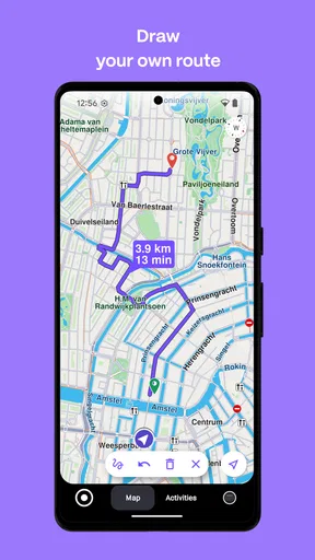
I would recommend giving it a careful test if offline map access matters to you, you travel through changing coverage, or you want to compare a different routing style with the app you already know. It may also suit people who want one tool for driving, cycling, and walking rather than separate route planners. The strongest test is personal: choose a short trip you know, then check whether the map is readable, the instructions arrive in time, and the suggested route makes sense.
I would be more hesitant to recommend it as a first choice to someone who needs highly predictable accessibility controls, relies on an established routine with another navigation app, or cannot spare attention to learn a new interface while travelling. In those cases, keep the familiar option available and test Magic Earth only when a passenger can help or the journey is low stakes. The free starting point makes comparison possible, but optional purchases still deserve a clear look before you commit.
A measured inclusive verdict
My view is that Magic Earth can be useful for people who prepare ahead and value offline mapping, but its suitability depends on more than the feature list. A person’s vision, hearing, dexterity, confidence with touchscreens, and travel environment all change what “easy to use” means. I would not call it universally accessible; I would judge it by a calm trial on your own device, with your own route and the guidance style you can comfortably follow.
That approach also answers the practical questions I would ask before depending on it: can I navigate after downloading a map, will traffic remain live without connectivity, and should I replace my current app immediately? Offline maps help when coverage disappears, but live traffic depends on connectivity; a trial on familiar roads is safer than an abrupt switch. If the app proves clear and dependable for your needs, keep it as a useful option. If not, choosing a more familiar alternative is a sensible decision, not a failure to give it a chance.
Features Galore
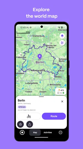
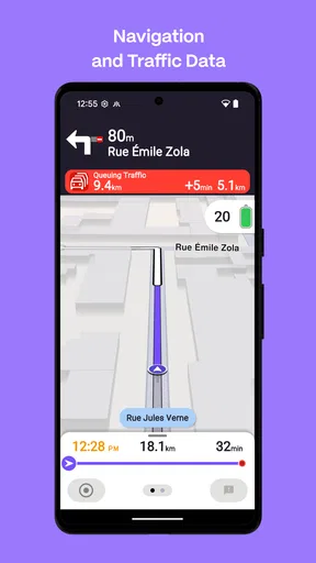
Now, let’s talk features. This app is packed with them! From high-quality offline maps to real-time traffic updates, Magic Earth has it all. One of my favorite features is the voice-guided navigation available in multiple languages. It’s like having a co-pilot who never gets tired of repeating directions. Plus, lane guidance is a lifesaver when you’re navigating those tricky highway exits.
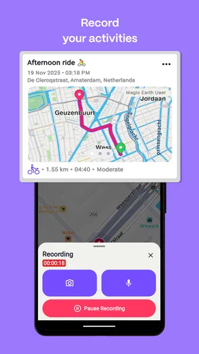
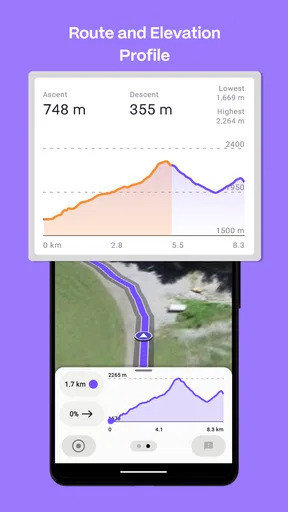
Another standout feature is the ability to download maps for offline use. This is perfect for those moments when you find yourself in a dead zone with no signal. The app also offers bike and pedestrian navigation, which is great for urban explorers. And let’s not forget about the weather updates and the 3D landmarks, which add a bit of flair to your typical navigation experience.
Performance and Usability
Performance-wise, Magic Earth Navigation & Maps is pretty solid. The app runs smoothly on both Android and iOS, and I didn’t encounter any major glitches or crashes during my test drives. It’s responsive, and the maps load quickly, which is crucial when you’re on the road. The app also integrates well with your calendar, allowing you to plan routes based on your appointments. How cool is that?
Usability is another area where this app shines. The search function is robust, and it didn’t take long to find even the most obscure destinations. You can also save your favorite places for quick access later. I found the app to be quite helpful in planning my daily commute and weekend getaways.
A Few Areas for Improvement
While Magic Earth is impressive, there’s always room for improvement. One thing I noticed is that the app could benefit from more frequent updates to its points of interest. I found a few outdated listings, which could be annoying if you rely heavily on recommendations for food or attractions. Additionally, while the app supports many languages, not all features are available in every language, which might be a downside for some users.
The Final Verdict
All in all, Magic Earth Navigation & Maps is a fantastic choice for anyone looking for a reliable and feature-packed navigation app. Whether you’re a daily commuter or an adventurous traveler, this app has something to offer. Its combination of offline capabilities, real-time updates, and user-friendly interface make it a strong contender in the world of navigation apps.
If you’re ready to upgrade your navigation game, give Magic Earth a try. It might just be the guide you’ve been searching for. Safe travels!
Pros
- User-friendly interface for easy navigation.
- Comprehensive offline maps available.
- Real-time traffic updates enhance routing.
- Free to use without hidden costs.
- 3D map views for better orientation.
Cons
- Occasional inaccuracies in lesser-known areas.
- Limited customization for map themes.
- High battery consumption during use.
- Voice navigation lacks diverse languages.
- Ad-supported
- can be distracting.
FAQs for Magic Earth Navigation & Maps
What features does Magic Earth Navigation & Maps offer?
Magic Earth Navigation & Maps provides a comprehensive set of features including turn-by-turn navigation, real-time traffic updates, offline maps, and 3D landmarks. The app also supports multiple languages and offers voice-guided navigation. Users can explore routes for driving, cycling, and walking, making it versatile for various travel needs.
Is Magic Earth Navigation & Maps free to use?
Yes, Magic Earth Navigation & Maps is free to download and use. The app offers extensive features without any hidden costs or subscription fees. However, users should be aware that using online features like real-time traffic updates may incur data charges depending on their mobile data plan.
Can I use Magic Earth Navigation & Maps offline?
Absolutely. Magic Earth allows users to download maps for offline use, which is especially useful when traveling in areas with limited internet connectivity. Offline maps ensure that you can navigate without relying on mobile data, providing uninterrupted guidance wherever you are.
How accurate is the real-time traffic information in Magic Earth?
Magic Earth utilizes a combination of data sources to provide accurate real-time traffic information. This includes crowd-sourced data and information from traffic authorities. While generally reliable, users should keep in mind that traffic conditions can change rapidly and may affect the accuracy of updates.
What privacy measures does Magic Earth Navigation & Maps have in place?
Magic Earth is designed with privacy in mind. The app does not store or share personal data with third parties. It only collects minimal, anonymized data necessary to improve its services. Users can navigate and explore maps with confidence, knowing that their privacy is safeguarded.


